January 9, 2025
OpenStreetMap Utah 2024 Year In Review
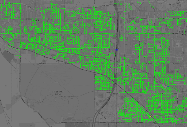
We had a very productive year improving OSM in Utah in 2024! Here are some numbers and highlights we would like to share with you.
We had a very productive year improving OSM in Utah in 2024! Here are some numbers and highlights we would like to share with you.
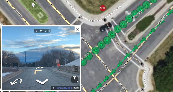
Mapillary is a cool crowdsourced street-level imagery project. Think Google Streetview, but with an open license for the images and pictures taken by people…